Japanese version is here
I am doing analysis of TRMM satellite data at HyARC, Nagoya University, Japan.
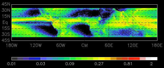
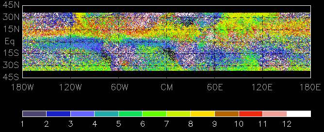
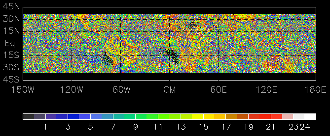
Following figures are maps of mean rain rate, month with maximum monthly rain,
and local time with maximum rain rate during 10 yrs from Jan. 1998,
observed with TRMM PR. These figures have no lines for world map. But
you may be able to recognize. It does not rain uniformly.
There is a strong regional dependency. Especially,
the map of month with maximum monthly rain
shows the difference between north and south and the
map of local time with maximum rain rate shows the difference between land and ocean.
Major subjects of my investigation are
- spatially and time variations of various rain characteristics derived from TRMM
- spatially and time variations of land emissivity over clear region derived from TRMM and JRA25
- Improvement of rain retrieval using land emissivity
- correlation of rain characteristics with current of sea water
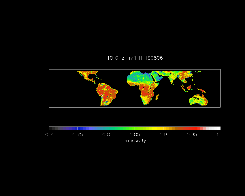
Following figure is a map of land emissivity of 10 GHz holizontal microwave during Jun. 1998, derived from TRMM and JRA25, using an assumption.
old lab's Home Page